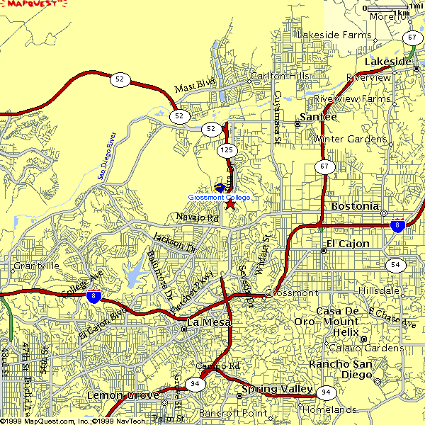
MAPS: Detailed - Southern CA - Main Directions - Health Professions Location
The campus map that shows the location of the Health Professions Offices is in PDF format. To view this file, Adobe Acrobat Reader must be installed on your computer. The application my be downloaded by visiting http://www.adobe.com/reader.
** From I-8 East, take the Lake Murray Boulevard exit (North). This bears around to the right and loops OVER I-8. Follow Lake Murray Boulevard for approximately 4 - 4 1/2 miles and go through the stop LIGHT at Navajo Road. Take a right at the next stop SIGN onto Highwood Drive. Bear to your left onto the perimeter road that goes around the campus. Park in parking lot #3A (identified by a SMALL sign at the entrance to the lot!). The Health Professions offices are located in building 34 room 256 which is located on the second floor of building 34.
* From I-8 West, take the Lake Murray Boulevard exit (North). Follow Lake Murray Boulevard for approximately 4 - 4 1/2 miles and go through the stop LIGHT at Navajo Road. Take a right at the next stop SIGN onto Highwood Drive. Bear to your left onto the perimeter road that goes around the campus. Park in parking lot #3A (identified by a SMALL sign at the entrance to the lot!). The Health Professions offices are located on the second floor of building 34 in room 256.


8800 Grossmont College Drive
El Cajon, California 92020
619-644-7000
Accessibility
Social Media Accounts